-
 Novo Nordisk's obesity drug Wegovy goes on sale in China
-
Spain royals to visit flood epicentre after chaotic trip: media
-
 French farmers step up protests against EU-Mercosur deal
-
Rose says Europe Ryder Cup stars play 'for the badge' not money

-
 Negotiators seek to break COP29 impasse after G20 'marching orders'
-
Burst dike leaves Filipino farmers under water
-
 Markets rally after US bounce as Nvidia comes into focus
-
Crisis-hit Thyssenkrupp books another hefty annual loss

-
 US envoy in Lebanon for talks on halting Israel-Hezbollah war
-
India to send 5,000 extra troops to quell Manipur unrest

-
 Sex, drugs and gritty reality on Prague's underworld tours
-
Farmers descend on London to overturn inheritance tax change

-
 Clippers upset Warriors, Lillard saves Bucks
-
Acquitted 'Hong Kong 47' defendant sees freedom as responsibility

-
 Floods strike thousands of houses in northern Philippines
-
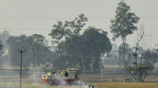
Illegal farm fires fuel Indian capital's smog misery
-
 SpaceX set for Starship's next flight, Trump expected to attend
-
Texans cruise as Cowboys crisis deepens

-
 Do the Donald! Trump dance takes US sport by storm
-
Home hero Cameron Smith desperate for first win of 2024 at Australian PGA

-
 Team Trump assails Biden decision on missiles for Ukraine
-
Hong Kong court jails 45 democracy campaigners on subversion charges

-
 Several children injured in car crash at central China school
-
Urban mosquito sparks malaria surge in East Africa

-
 Djibouti experiments with GM mosquito against malaria
-
Pulisic at the double as USA cruise past Jamaica

-
 Many children injured after car crashes at central China school: state media
-
Asian markets rally after US bounce as Nvidia comes into focus

-
 Tens of thousands march in New Zealand Maori rights protest
-
Five takeaways from the G20 summit in Rio

-
 China, Russia ministers discuss Korea tensions at G20: state media
-
Kohli form, opening woes dog India ahead of Australia Test series

-
 Parts of Great Barrier Reef suffer highest coral mortality on record
-
Defiant Lebanese harvest olives in the shadow of war

-
 Russian delegations visit Pyongyang as Ukraine war deepens ties
-
S.Africa offers a lesson on how not to shut down a coal plant

-
 Italy beat Swiatek's Poland to reach BJK Cup final
-
Japan, UK to hold regular economic security talks

-
 Divided G20 fails to agree on climate, Ukraine
-
Can the Trump-Musk 'bromance' last?

-
 US to call for Google to sell Chrome browser: report
-
Macron hails 'good' US decision on Ukraine missiles

-
 Italy eliminate Swiatek's Poland to reach BJK Cup final
-
Trump expected to attend next Starship rocket launch: reports

-
 Israeli strike on Beirut kills 5 as deadly rocket fire hits Israel
-
Gvardiol steals in to ensure Croatia reach Nations League quarter-finals

-
 Thousands march to New Zealand's parliament in Maori rights protest
-
China's Xi urges G20 to help 'cool' Ukraine crisis

-
 Church and state clash over entry fee for Paris's Notre Dame
-
Holders Spain strike late to beat Switzerland in Nations League


Powerful Hurricane Beryl slams into Caribbean island of Carriacou
Hurricane Beryl slammed into the Caribbean island of Carriacou on Monday, producing "life-threatening conditions" including disastrous winds, according to US trackers, after the storm strengthened into a powerful Category 4 storm.
With the "extremely dangerous eyewall" moving over the island, which is part of Grenada, the US National Hurricane Center warned residents "not leave their shelter as winds will rapidly increase."
The eye of Beryl made landfall on Carriacou Island at 1510 GMT, the NHC reported on X, adding in a bulletin that it was creating "catastrophic winds and life-threatening storm surge."
Posting a video showing large waves, the Office of the Prime Minister of Grenada wrote on Facebook that the tri-island state was "experiencing intense winds and damage."
"This is an extremely dangerous and life-threatening situation," the NHC said. "Residents should not leave their shelter and remain in place through the passage of these life-threatening conditions."
Experts say that such a powerful storm forming this early in the Atlantic hurricane season -- which runs from early June to late November -- is extremely rare.
"Only five major (Category 3+) hurricanes have been recorded in the Atlantic before the first week of July," hurricane expert Michael Lowry posted on social media platform X.
"Beryl would be the sixth and earliest this far east in the tropical Atlantic."
Grenada Prime Minister Dickon Mitchell urged citizens to quickly seek shelter and respect an island-wide curfew ordered for 7:00 pm to 7:00 am Tuesday morning.
Farther northeast in the Caribbean, officials in Barbados said the island was buffeted by high winds and pelting rain, but appeared to have avoided disaster, reporting no injuries so far.
Barbados seems to have "dodged a bullet," Minister of Home Affairs and Information Wilfred Abrahams said in a video, but nonetheless "gusts are still coming, the storm-force winds are still coming" he said, warning residents to remain inside until the all-clear.
Barbados, Grenada, plus Saint Vincent and the Grenadines, and Tobago were all under hurricane warnings, the NHC said, while a hurricane watch or tropical storm warnings or watches were in effect for Jamaica, Martinique, Trinidad, St Lucia, and parts of the Dominican Republic and Haiti.
A state of emergency was declared in Tobago, the smaller of the two islands that make up Trinidad and Tobago, with schools ordered closed on Monday, top official Farley Augustine said.
A meeting this week in Grenada of the Caribbean regional bloc CARICOM was postponed.
- Extreme weather -
Beryl became the first hurricane of the 2024 Atlantic season early Saturday morning and quickly strengthened to Category 4, the first ever to reach that level in June, according to NHC records.
A Category 3 or higher on the Saffir-Simpson scale is considered a major hurricane, and a Category 4 storm packs sustained winds of at least 130 miles per hour (209 kilometers per hour).
As Beryl struck Carriacou, it was packing maximum sustained winds that had increased to 150 mph, the NHC said.
Beryl is expected to remain powerful as it moves across the Caribbean, the NHC said, warning residents and officials in the Lesser Antilles, Hispaniola, Jamaica, the Cayman Islands and the remainder of the northwestern Caribbean to carefully monitor its progress.
The agency cited warm Atlantic Ocean temperatures and conditions related to the weather phenomenon La Nina in the Pacific for the expected increase in storms.
Extreme weather events including hurricanes have become more frequent and more devastating in recent years as a result of climate change.
Th.Gonzalez--AT

